


Three hurricanes that are churning in the Pacific represent a level of elevated activity consistent with El Nino.
This is a naturally occurring phenomenon characterised by warmer-than-normal sea surface temperatures in that ocean.
Forecasters have warned it is almost certain that this year's El Nino will intensify into a very strong event in the coming months and last until February 2027.
It usually takes place irregularly every two to seven years and lasts nine to 12 months, but this year's has been forecast to be "exceptional" having been "supersized", according to the United Nations.
Hurricane Lowell, which could target Hawaii this weekend, reached the maximum category five strength on Wednesday before later weakening to a category three.
Karina has weakened from a category three to category two east of the Hawaiian Islands and is forecast to weaken further in the next 48 hours, according to the National Hurricane Centre.
But Marie, located nearly 400 miles off the coast of Mexico's Baja California Peninsula, is strengthening.
The storm could create strong swells for parts of Mexico's southwestern coast and Baja California through the weekend, and perhaps Southern California, according to the centre.
There are predictions by the National Oceanic and Atmospheric Administration (NOAA) and other groups of an exceptionally strong El Nino, or "super El Nino" this year, marked by water temperatures at least 2C above average in the Pacific.
This El Nino event has a 69% chance of becoming the strongest ever recorded, according to a NOAA forecast last month.
The event has taken hold at a point when sea surface temperatures in the Pacific were already significantly raised.
Scientists have been monitoring a vast marine heatwave - a prolonged period of unusually high ocean temperatures - in the Pacific that started in 2025.
Meteorologist Daniel Gilford said early studies by his research group Climate Central have found around 94% of the Pacific has experienced heatwave conditions since January, with some regions already up to 2C warmer than normal.
"Temperatures across the entire Pacific Ocean are elevated, and we're certainly seeing that in the region where these hurricanes and tropical cyclones are traversing," he said.
El Nino usually exacerbates warming from climate change, further increasing global temperatures and pushing up the chances of extreme weather.
Read more from Sky News:
New map that shows Africa's true size backed by UN
Tennis world number one stops play at US Open
United Nations secretary-general António Guterres said on Thursday that El Nino is "being supersized before our eyes".
"The science leaves no room for doubt: The planet is in uncharted waters, and those waters are heating up," he said.
Mr Guterres was reacting to a new World Meteorological Organisation report that El Nino "is firmly established and will intensify into a very strong event in the coming months, with big impacts on rainfall and temperature patterns and associated risks of floods, drought and extreme heat".

(c) Sky News 2026: Three hurricanes in Pacific show the power of El Nino
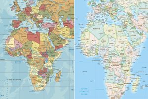 Countries vote at UN to back world map that shows Africa's true size
 Trump says US envoys bringing 'proposal to end war' to Russia and Ukraine
 Jason Arday: University of Cambridge will review 'decision-making' after death of professor
 Ex-referee Mike Dean responds after backlash over revelations on Jamie Vardy podcast